 Republic of El Salvador: All Data
This page is about the data available for this polity; the chronology of its events is available here.
Is a country in central America. It separated from Spain as part of the Federal Republic of Central America, and later became an independent country in 1841.
1. Genealogy

2. Maps of Political Control Over Time
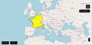
 Republic of El Salvador : Map showing the initial year each territory was ruled by the polity
Republic of El Salvador : Maximal Extension of the Polity
Republic of El Salvador : Map showing the initial year each territory was ruled by the polity
Republic of El Salvador : Maximal Extension of the Polity
3. Administrative Divisions
4. Monthly Summaries

5. Time Series
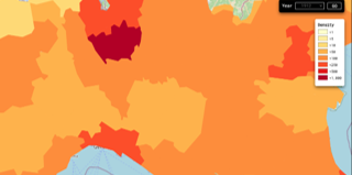
 Republic of El Salvador : Time Series of all Territorial Changes
Republic of El Salvador : time series of its population and area throughout history
Republic of El Salvador : Time Series of all Territorial Changes
Republic of El Salvador : time series of its population and area throughout history
6. All Cities mentioned in Territorial Changes
 Ahuachapán
Chalatenango
Cojutepeque
La Unión (El Salvador)
San Francisco Gotera
San Miguel
San Salvador
San Vicente
Santa Ana
Santa Tecla
Sensuntepeque
Sonsonate
Usulután
Zacatecoluca
Ahuachapán
Chalatenango
Cojutepeque
La Unión (El Salvador)
San Francisco Gotera
San Miguel
San Salvador
San Vicente
Santa Ana
Santa Tecla
Sensuntepeque
Sonsonate
Usulután
Zacatecoluca
Ahuachapán
Chalatenango
Cojutepeque
La Unión (El Salvador)
San Francisco Gotera
San Miguel
San Salvador
San Vicente
Santa Ana
Santa Tecla
Sensuntepeque
Sonsonate
Usulután
Zacatecoluca
Ahuachapán
Chalatenango
Cojutepeque
La Unión (El Salvador)
San Francisco Gotera
San Miguel
San Salvador
San Vicente
Santa Ana
Santa Tecla
Sensuntepeque
Sonsonate
Usulután
Zacatecoluca