 Union of the Comoros: All Data
This page is about the data available for this polity; the chronology of its events is available here.
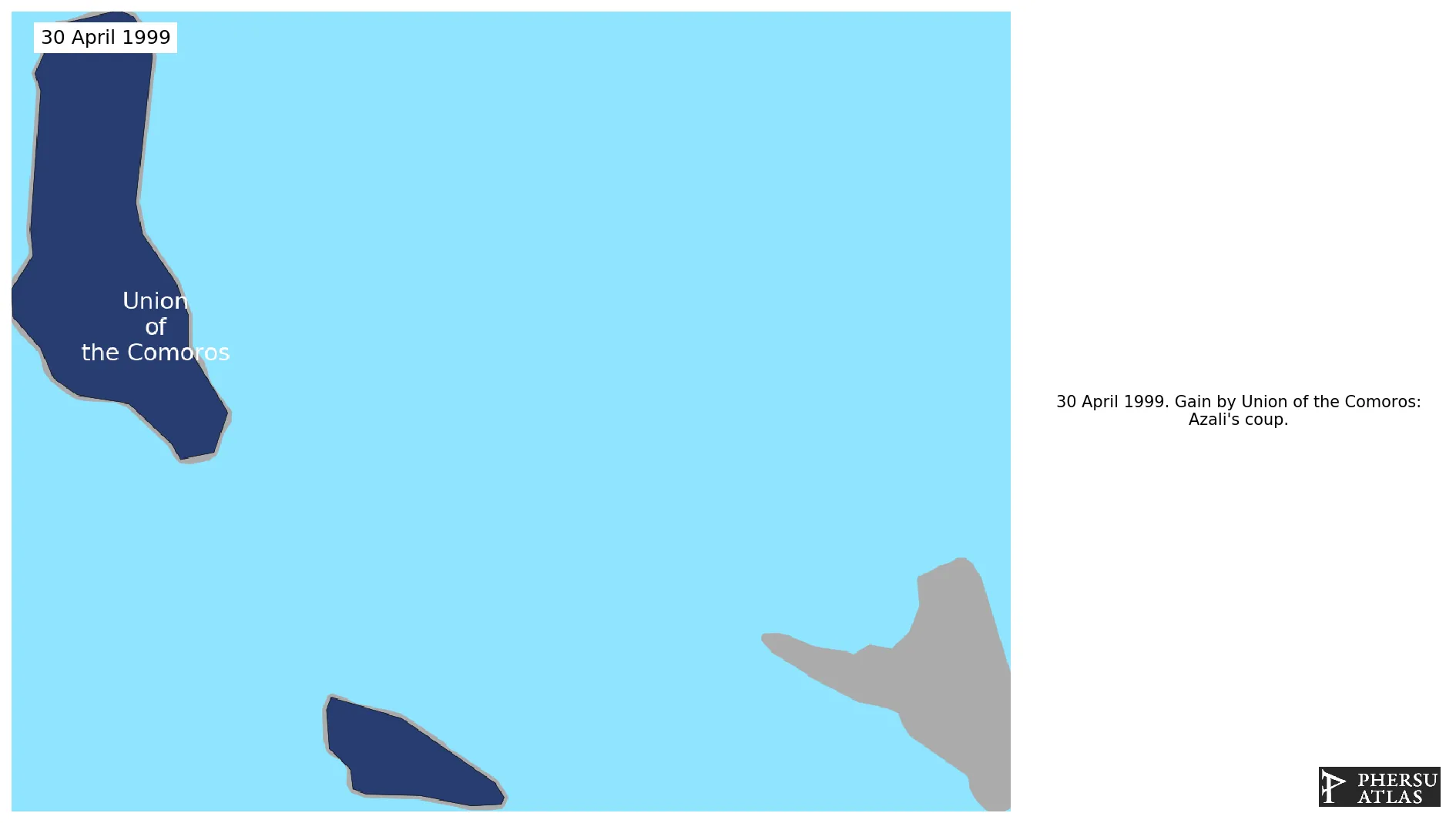
The Comoros is an archipelago in the Indian ocean, located northwest to Mozambique. The archipelago unilaterally declared its independence from France in 1975. It assumed its current denomination in 1999.
1. Genealogy

2. Maps of Political Control Over Time
 Union of the Comoros : Map showing the initial year each territory was ruled by the polity
Union of the Comoros : Maximal Extension of the Polity
Union of the Comoros : Map showing the initial year each territory was ruled by the polity
Union of the Comoros : Maximal Extension of the Polity
3. Monthly Summaries

4. Lists and Timelines
5. Rankings
 Union of the Comoros : Top wars ordered by largest reached area
Union of the Comoros : Top wars by territorial gain or loss in terms of area of the changes
Union of the Comoros : Top wars by territorial gain or loss in terms of area difference
Union of the Comoros : Top wars ordered by largest reached area
Union of the Comoros : Top wars by territorial gain or loss in terms of area of the changes
Union of the Comoros : Top wars by territorial gain or loss in terms of area difference
6. Time Series
Union of the Comoros : Time Series of all Territorial Changes
Union of the Comoros : time series of its population and area throughout history

