 State of Katanga: All Data
This page is about the data available for this polity; the chronology of its events is available here.
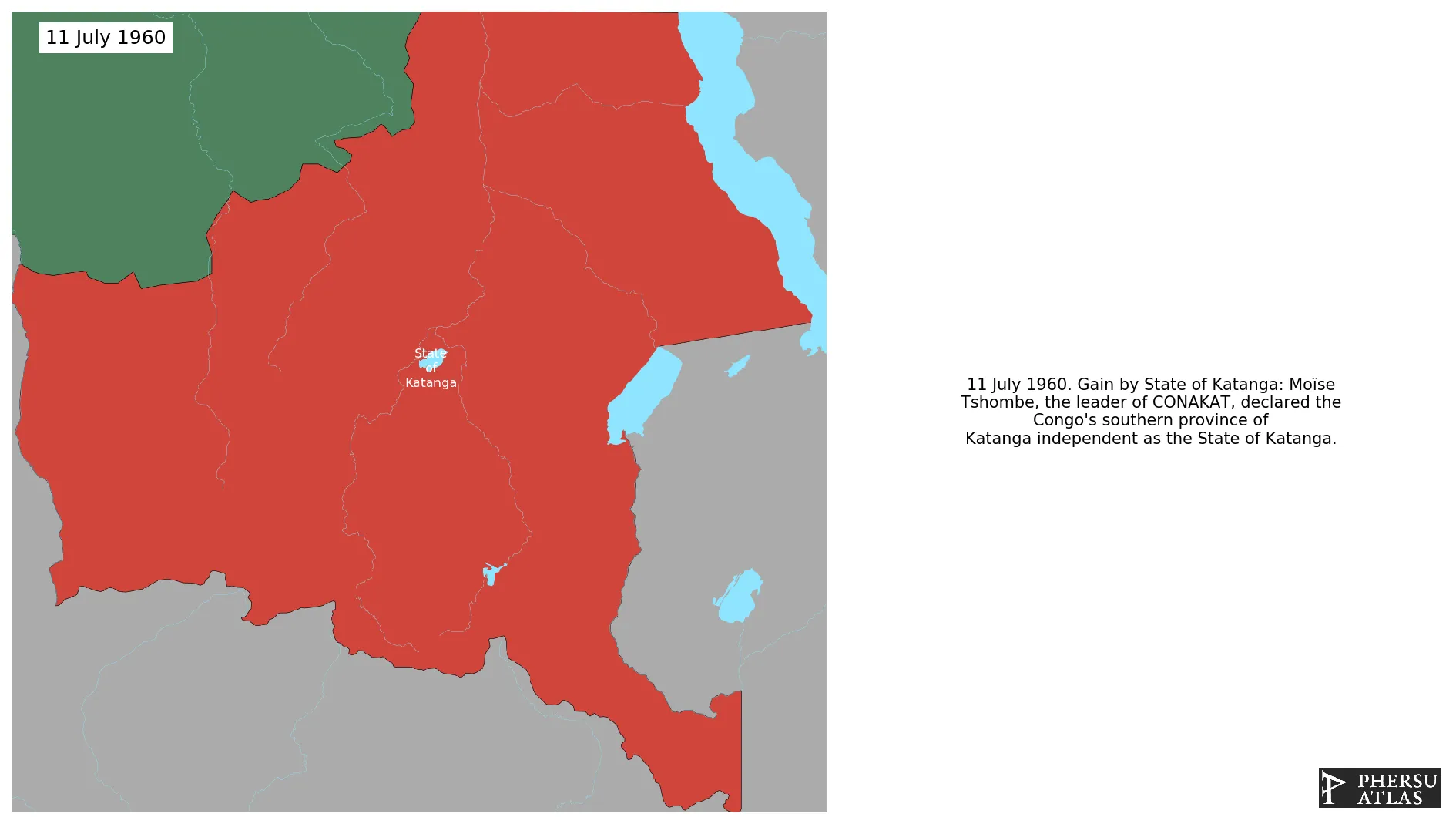
On 11 July 1960, Moïse Tshombe, the leader of CONAKAT, declared the Congo's southern province of Katanga independent as the State of Katanga.
1. Genealogy

2. Maps of Political Control Over Time
 State of Katanga : Map showing the initial year each territory was ruled by the polity
State of Katanga : Maximal Extension of the Polity
State of Katanga : Map showing the initial year each territory was ruled by the polity
State of Katanga : Maximal Extension of the Polity
3. Monthly Summaries

4. Lists and Timelines
5. Rankings
 State of Katanga : Top wars ordered by largest reached area
State of Katanga : Top wars by territorial gain or loss in terms of area of the changes
State of Katanga : Top wars by territorial gain or loss in terms of area difference
State of Katanga : Top wars ordered by largest reached area
State of Katanga : Top wars by territorial gain or loss in terms of area of the changes
State of Katanga : Top wars by territorial gain or loss in terms of area difference
6. Time Series
State of Katanga : Time Series of all Territorial Changes
State of Katanga : time series of its population and area throughout history
7. All Events mentioned in Territorial Changes

8. All Cities mentioned in Territorial Changes
 Jadotville
Bukama
Dilolo
Kabalo
Kalemie
Kambove
Kamina
Kaniama
Kasaji
Kipushi
Kolwezi
Kongolo
Likasi
Luanza
Lubumbashi
Manono
Moba
Nyunzu
Shinkolobwe
Shinkolobwe
Élisabethville
Kolwezi
Kolwezi
Bukama
Dilolo
Kambove
Kamina
Kaniama
Kasaji
Kipushi
Kolwezi
Likasi
Luanza
Manono
Moba
Jadotville
Kabalo
Kalemie
Kongolo
Moba
Nyunzu
Jadotville
Bukama
Dilolo
Kabalo
Kalemie
Kambove
Kamina
Kaniama
Kasaji
Kipushi
Kolwezi
Kongolo
Likasi
Luanza
Lubumbashi
Manono
Moba
Nyunzu
Shinkolobwe
Shinkolobwe
Élisabethville
Kolwezi
Kolwezi
Bukama
Dilolo
Kambove
Kamina
Kaniama
Kasaji
Kipushi
Kolwezi
Likasi
Luanza
Manono
Moba
Jadotville
Kabalo
Kalemie
Kongolo
Moba
Nyunzu