 Republic of Panama: All Data
This page is about the data available for this polity; the chronology of its events is available here.
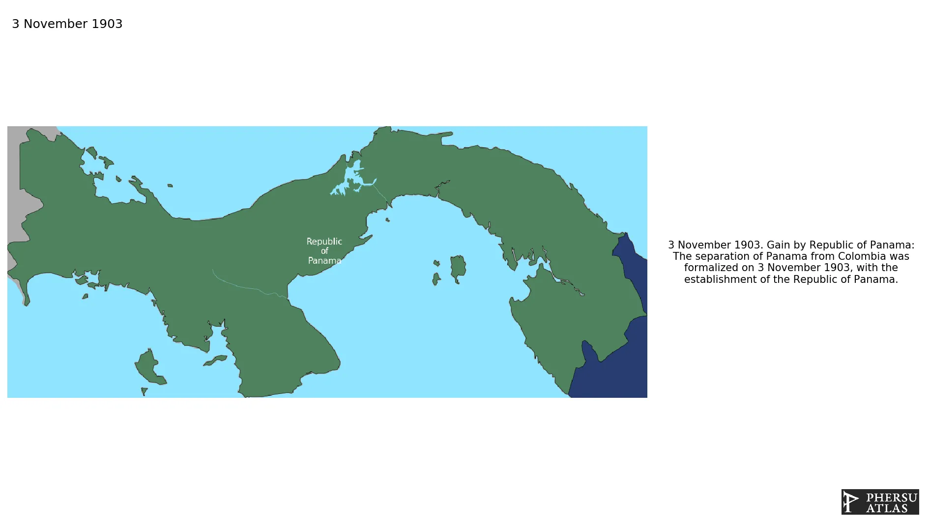
Is a transcontinental country spanning the southern part of North America and the northern part of South America. The separation of Panama from Colombia was formalized on 3 November 1903, with the establishment of the Republic of Panama. The Panama canal zone was controlled by the United States from 1903 to 1979, and was under joint U.S.-Panamian control from 1979 to 1999.
1. Genealogy

2. Maps of Political Control Over Time
 Republic of Panama : Map showing the initial year each territory was ruled by the polity
Republic of Panama : Maximal Extension of the Polity
Republic of Panama : Map showing the initial year each territory was ruled by the polity
Republic of Panama : Maximal Extension of the Polity
3. Administrative Divisions
4. Monthly Summaries

5. Lists and Timelines
6. Rankings
 Republic of Panama : Top wars ordered by largest reached area
Republic of Panama : Top wars by territorial gain or loss in terms of area of the changes
Republic of Panama : Top wars by territorial gain or loss in terms of area difference
Republic of Panama : Top wars ordered by largest reached area
Republic of Panama : Top wars by territorial gain or loss in terms of area of the changes
Republic of Panama : Top wars by territorial gain or loss in terms of area difference
7. Time Series
Republic of Panama : Time Series of all Territorial Changes
Republic of Panama : time series of its population and area throughout history
8. All Events mentioned in Territorial Changes

9. All Cities mentioned in Territorial Changes
 Almirante
Balboa
Bocas Town
Chitré
Colón (Panama)
Davíd
Jaqué
La Palma
Las Tablas
Panama City
Penonomé
Puerto Armuelles
Santiago de Veraguas
Almirante
Bocas Town
Chitré
Colón (Panama)
Davíd
Jaqué
La Palma
Las Tablas
Panama City
Penonomé
Puerto Armuelles
Santiago de Veraguas
Panama City
Davíd
Colón (Panama)
Fort Amador
Balboa
Colón (Panama)
Almirante
Bocas Town
Chitré
Davíd
Jaqué
La Palma
Las Tablas
Penonomé
Puerto Armuelles
Santiago de Veraguas
Colón (Panama)
Almirante
Balboa
Bocas Town
Chitré
Colón (Panama)
Davíd
Jaqué
La Palma
Las Tablas
Panama City
Penonomé
Puerto Armuelles
Santiago de Veraguas
Almirante
Bocas Town
Chitré
Colón (Panama)
Davíd
Jaqué
La Palma
Las Tablas
Panama City
Penonomé
Puerto Armuelles
Santiago de Veraguas
Panama City
Davíd
Colón (Panama)
Fort Amador
Balboa
Colón (Panama)
Almirante
Bocas Town
Chitré
Davíd
Jaqué
La Palma
Las Tablas
Penonomé
Puerto Armuelles
Santiago de Veraguas
Colón (Panama)