 Republic of Liberia: All Data
This page is about the data available for this polity; the chronology of its events is available here.
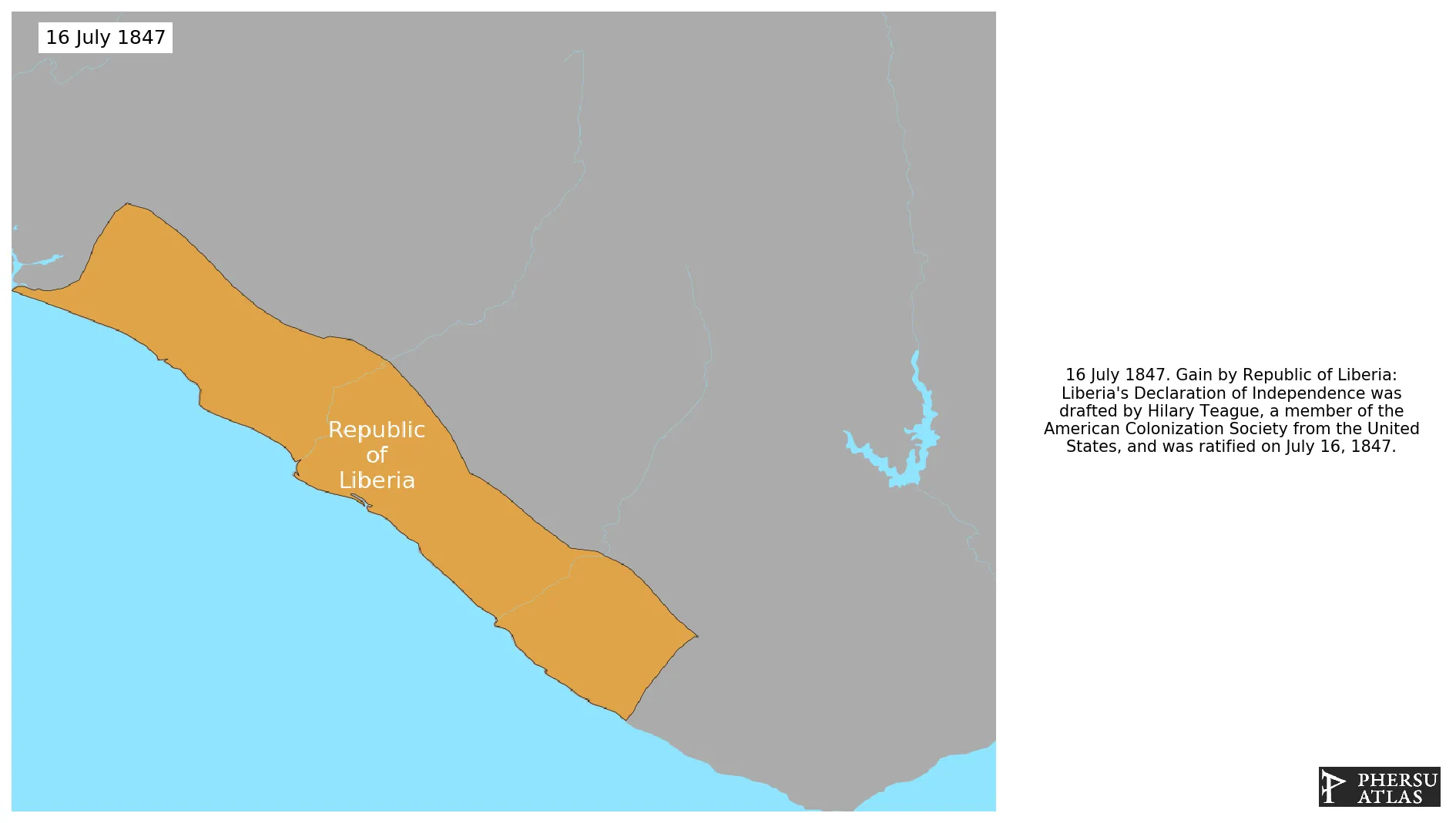
Is a country on the West African coast. It is bordered by Sierra Leone to its northwest, Guinea to its north, Ivory Coast to its east, and the Atlantic Ocean to its south and southwest. Liberia emerged from the union of several private colonies founded by the American Colonization Society (ACS). The ACS was an organization that encouraged and supported the migration African-Americans to Africa. The Republic of Liberia declared independence in 1847, being one of the few countries in Africa that remained indepedent since then.
1. Genealogy

2. Maps of Political Control Over Time
 Republic of Liberia : Map showing the initial year each territory was ruled by the polity
Republic of Liberia : Maximal Extension of the Polity
Republic of Liberia : Map showing the initial year each territory was ruled by the polity
Republic of Liberia : Maximal Extension of the Polity
3. Administrative Divisions
4. Monthly Summaries

5. Lists and Timelines
6. Rankings
 Republic of Liberia : Top wars ordered by largest reached area
Republic of Liberia : Top wars by territorial gain or loss in terms of area of the changes
Republic of Liberia : Top wars by territorial gain or loss in terms of area difference
Republic of Liberia : Top wars ordered by largest reached area
Republic of Liberia : Top wars by territorial gain or loss in terms of area of the changes
Republic of Liberia : Top wars by territorial gain or loss in terms of area difference
7. Time Series
Republic of Liberia : Time Series of all Territorial Changes
Republic of Liberia : time series of its population and area throughout history
8. All Events mentioned in Territorial Changes

9. All Cities mentioned in Territorial Changes
 Gbarnga
Sanniquellie
Voinjama
Barclayville
Greenville (Liberia)
Harper
Zwedru
Monrovia
Monrovia
Robertsport
Bensonville
Gbarnga
Robertsport
Sanniquellie
Voinjama
Barclayville
Greenville (Liberia)
Harper
River Cess
Zwedru
Barclayville
Harper
San Pédro
Gbarnga
Guéckédougou
Guiglo
Macenta
Nzérékoré
Sanniquellie
Voinjama
Yomou
Zwedru
San Pédro
Guiglo
Guéckédougou
Macenta
Nzérékoré
Yomou
River Cess
Barclayville
Harper
San Pédro
Gbarnga
Sanniquellie
Voinjama
Barclayville
Greenville (Liberia)
Harper
Zwedru
Monrovia
Monrovia
Robertsport
Bensonville
Gbarnga
Robertsport
Sanniquellie
Voinjama
Barclayville
Greenville (Liberia)
Harper
River Cess
Zwedru
Barclayville
Harper
San Pédro
Gbarnga
Guéckédougou
Guiglo
Macenta
Nzérékoré
Sanniquellie
Voinjama
Yomou
Zwedru
San Pédro
Guiglo
Guéckédougou
Macenta
Nzérékoré
Yomou
River Cess
Barclayville
Harper
San Pédro